Mountain Hikers
About Us
Mountain Hikers is a Himalayan trekking community founded by Sandeep Singh Rana,
Social Account
Search
People also search for:
Kashmir has many beautiful lakes and springs. There are so many of them all over the place. A long time ago, our ancestors probably traveled through lots of mountains and valleys to find these amazing gifts from nature. Ever since then, they have respected and cherished them a lot.
In Kashmiri, a lake is known as a Sar or Bal. Kashmir has a lot of lakes, including the Great Lakes of Kashmir! These lakes are located way up high, over 12000 ft, in the Himalayas. The only way to get to them is by trekking in the mountains or riding on a horse.
The Kashmir Great Lakes(KGL) trek is definitely the most stunning trek in India. It’s like watching a 3D IMAX movie in real life! Plus, it’s super challenging too! You’ll climb rocky mountains with glaciers melting into streams, stroll through green meadows with sheep munching on grass, and see colorful wildflowers all along the path. And the best part is you’ll get to see at least 10 out of many emerald-turquoise alpine lakes, 5 different valleys, and 3 very high passes. It’s like looking at a huge canvas filled with different colors and shades. The whole experience is just amazing!
In 2019, I went on my first Himalayan trek to Tarsar Marsar in Kashmir and it was amazing! I really wanted to see more lakes like that, so I decided to try the KGL trek next. It’s tougher and you get to see even more lakes in the same amount of time. But, the trek got cancelled two years in a row. Finally, this year, I got to go and it was a dream come true!
About The Trek
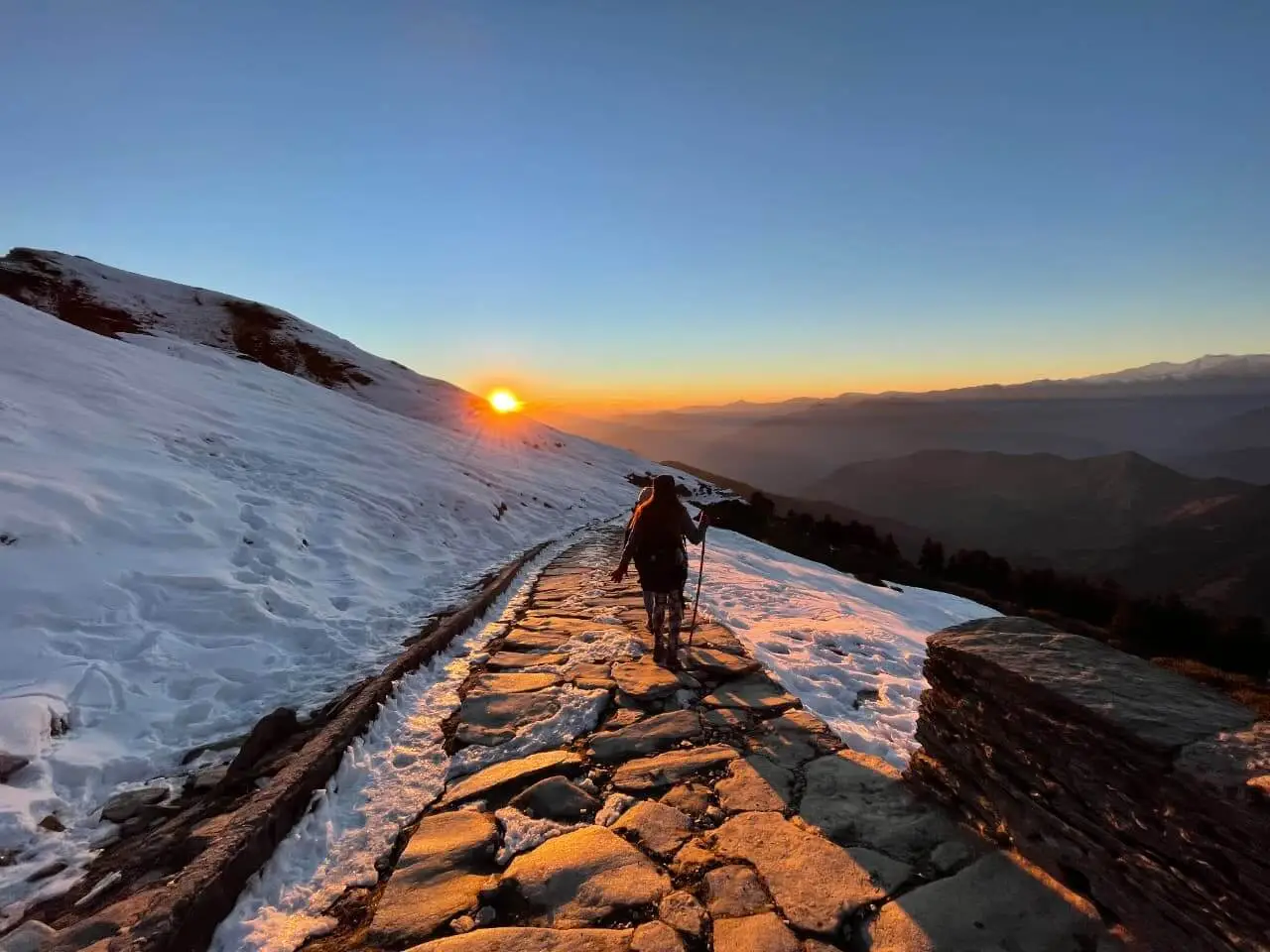
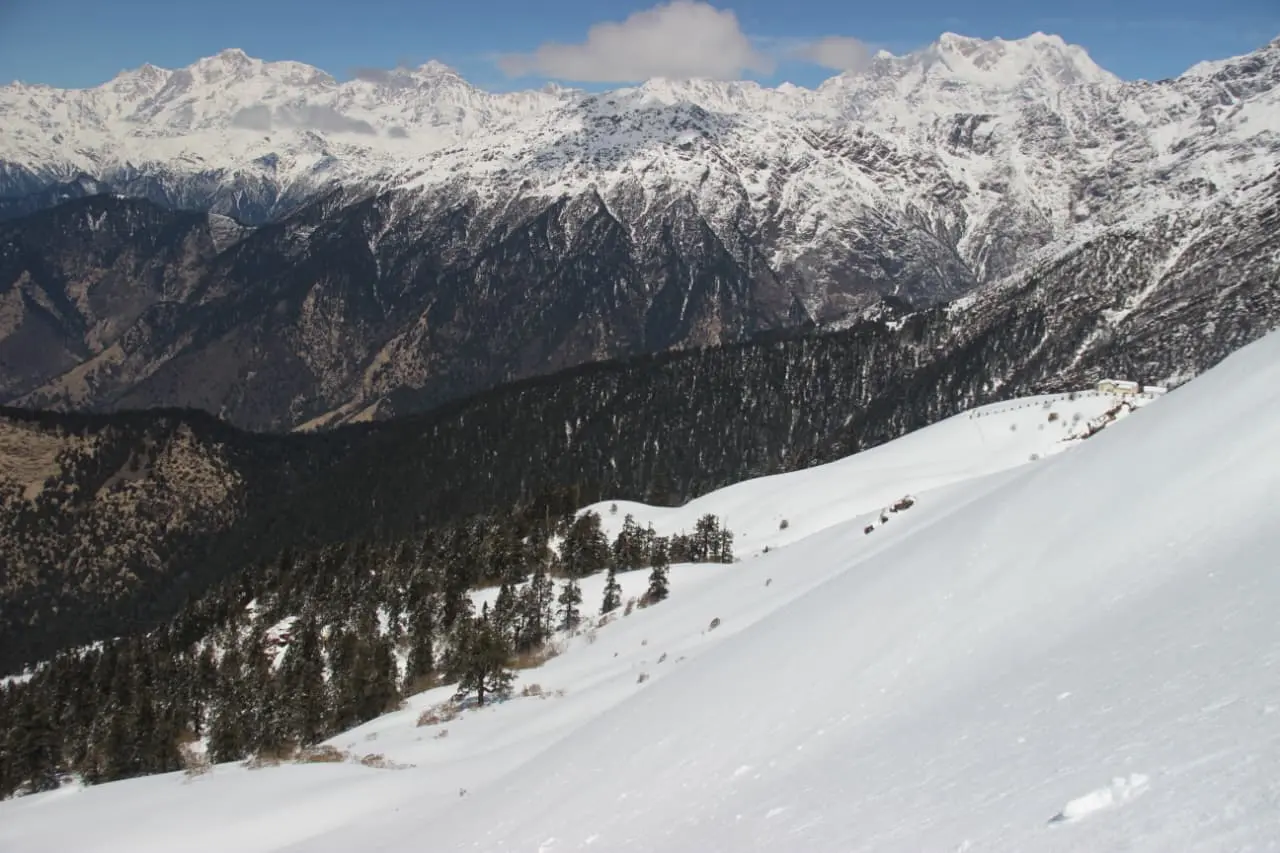
Kashmir’s high altitude treks are only possible from July to September due to frozen lakes and snowy mountains during the rest of the year. I did a 6-day trek in early August 2022, with an extra day for bad weather. The trek covered 74 km, including steep mountain passes, flat meadows, and rocky climbs. The weather can be very unpredictable!
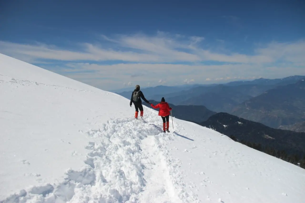
You have to have healthy lungs, strong knees, and a determined mind to complete the journey. Being physically fit is crucial, especially in your legs, but it’s really your determination and mental strength that will help you finish. Your age matters too. Even if you’re the youngest and most fit in the group, you might not be able to finish the hike if you get AMS. AMS can affect anyone once you reach high altitudes (above 10000 ft). Taking Diamox can help prevent AMS.
The KGL trek is often seen as a moderate-difficult journey, but in my opinion, it leans more towards the difficult side. The six-day trek involves long days of hiking up and down steep terrain. The weather can be unpredictable, with heavy rain, hail, or snow, and there are limited places to seek shelter. If you’re new to high-altitude treks, it’s best to choose a different trek to start with.
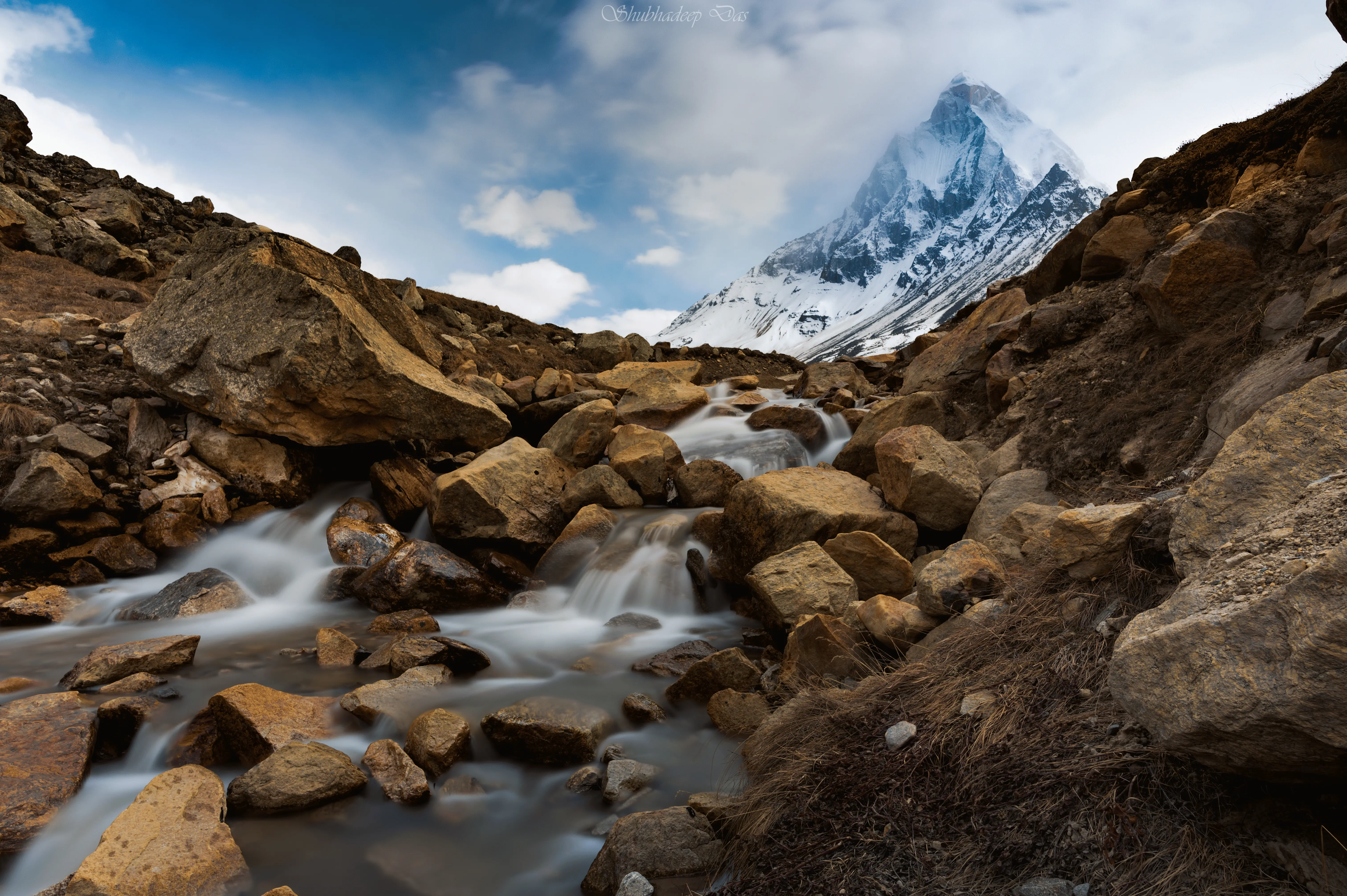
The hard work is definitely paying off. Every day is like a picture postcard, especially with some beautiful alpine lakes to explore. What makes these lakes even more beautiful is the glaciers that feed them, with big white pieces of ice often floating on the surface. And all the lakes are nestled under tall, rocky mountains, surrounded by miles of green fields with lots of colorful wildflowers swaying in the wind.
DAY ZERO – Srinagar to Shutkadi
Altitude 5200 ft to 7800 ft
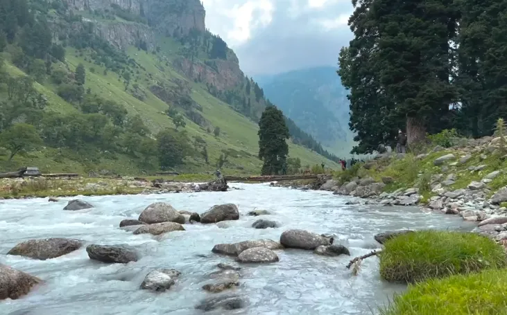
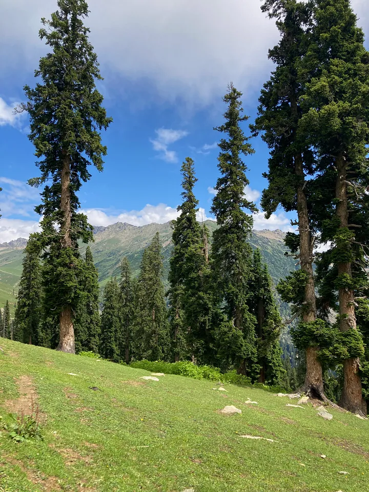
The base camp was located in Shutkadi, close to Sonamarg. Our group consisted of twenty people. We took a cab from Srinagar to reach the base camp, which took us approximately 2.5 hours. The last kilometer to the campsite had to be hiked with our heavy backpacks. Once we reached the campsite, we had the option to unload our backpacks and only carry a daypack each day. The campsite was situated on a high elevation, surrounded by mountains and clusters of pine trees, with a stunning view of the Sind River and the prominent Thajwas glacier peak in the distance. Among the trees, you could spot the occasional hut or shelter of a Gujjar Bakerwal.
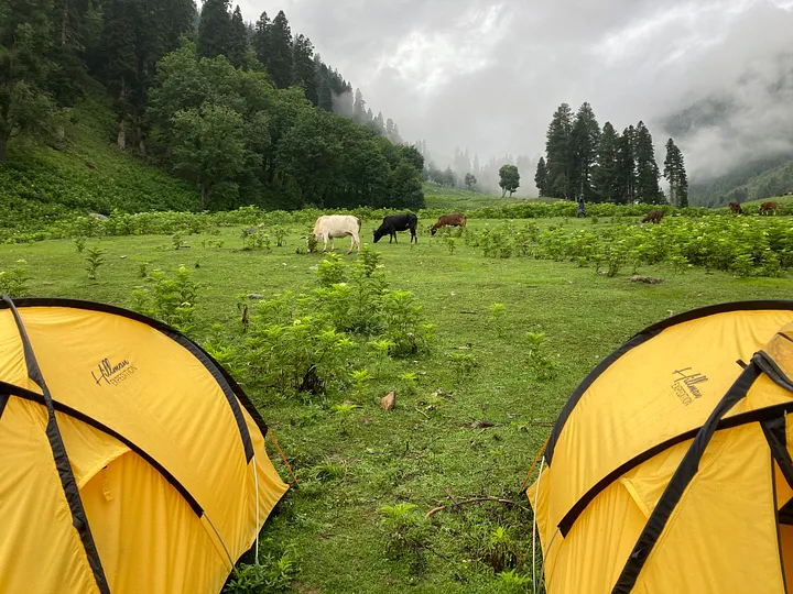
We had a chill evening – we strolled by the river, chatted over tea, did all the paperwork and health checks, had dinner, and hit the hay early for an early start the next day.
The morning routine was set in stone 6-7-8!
DAY 1: Shutkadi to Nichnai via Shekdur
Altitude: 7,800 ft to 11,500 ft
Distance: 11.6 km
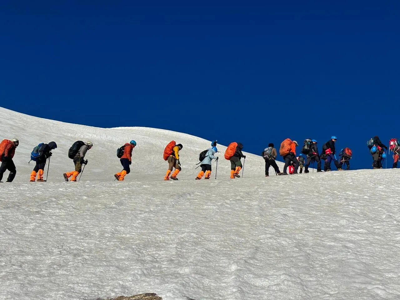
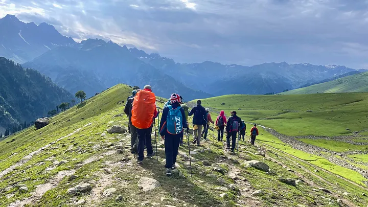
In the morning meeting, we were told that today would be the toughest day of the trek because we had to walk a lot of kilometers and climb more than 3000 ft. Usually, it’s not safe to climb more than 1000 ft in one day, but we had to make an exception because we could only camp at a certain spot.
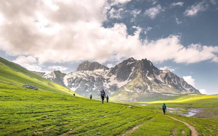
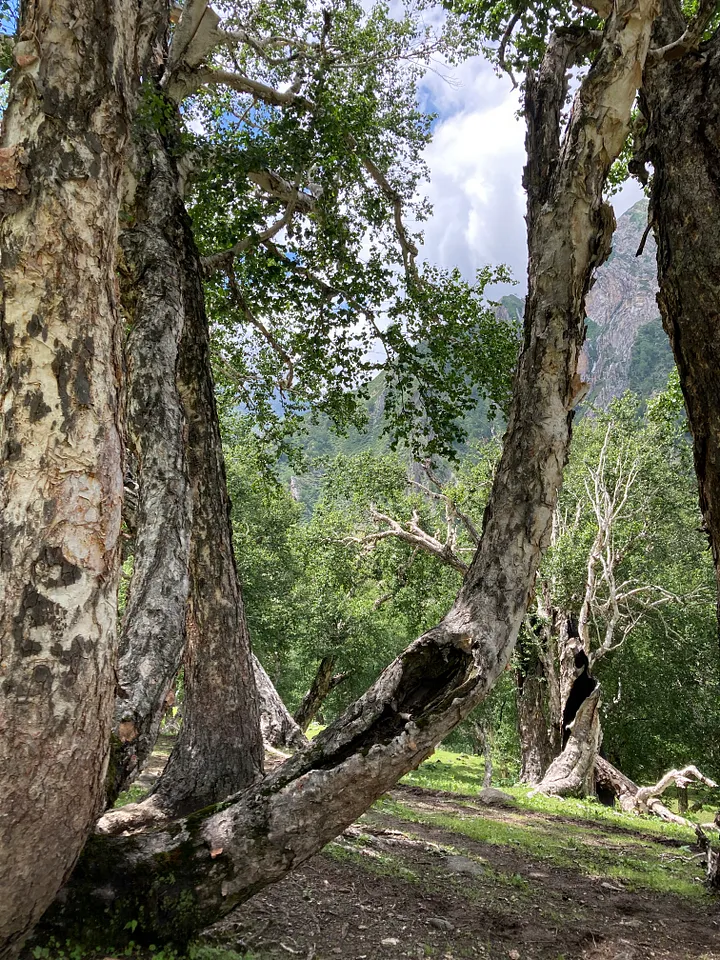
The morning started with a tough climb up to Table Top, a flat meadow. From there, we had a great view of the Sonamarg valley and the impressive Thajwas peak. We kept walking through lovely meadows and snowy peaks of Shekdur. Then, we went down through a gorgeous silver birch forest, where we enjoyed chatting with the trees. After that, we had to climb for a few more hours to reach Nichnai.
Even though the weather was great for most of the trip, the last 45 minutes of the first day were really intense. We were almost at our campsite when a sudden storm hit. We were totally unprepared and got drenched before we could put on our rain ponchos. There was lightning and thunder, and I started to worry about getting struck by lightning. The rain and hail were so strong, and we had nowhere to take cover. When we finally reached the campsite, we were cold, wet, and tired, but still excited about the day.
DAY 2: Nichnai to Vishansar Lake
Altitude: 11,500 ft to 12,000 ft
Distance: 13.5 km
After a great night’s sleep, we were excited to see our first lake of the trip that morning. The weather was perfect – the sky was clear and the sun was shining behind the mountains. It had rained all night, like it usually did, so we couldn’t dry our clothes and shoes from the day before. We packed them in plastic bags to dry at the next campsite, unless it kept raining. The issue was our shoes. We only had one pair each and they were completely wet! Luckily, we found out that stuffing newspaper or tissues into the shoes worked wonders.
We climbed for a while before reaching the tough climb to Nichnai Pass. The pass looks like a big tunnel with snowy mountains on one side and high land on the other. Nichnai Pass is 13,500 ft high. The climb to the pass is not too hard, but it goes on for a really long time, so it’s pretty challenging.
We were so happy when we reached the top of the pass. From there, we could see all the rocky peaks around us. We took lots of pictures so we could remember the moment later. We knew we would want to remember this when we were back in the hot plains.
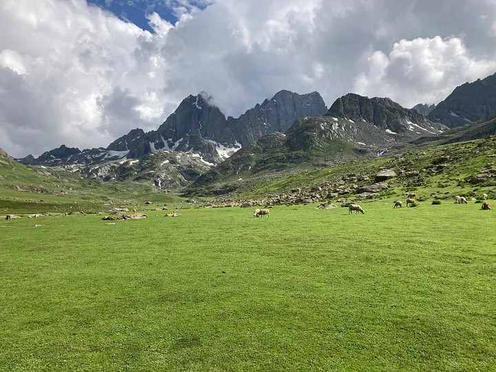
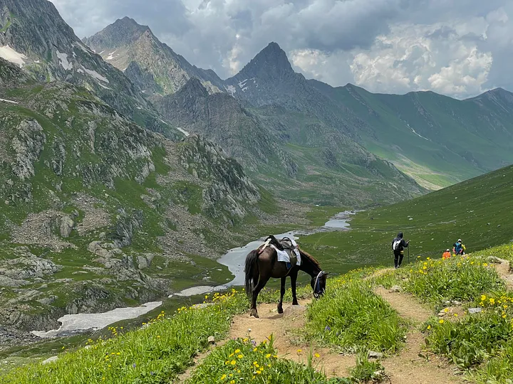
We walked downhill from the pass for a few hours, then strolled across grassy fields with sheep to get to Vishansar. We saw the lake from far away, sparkling in the sun by the Vishansar peak.
We got to the camp while the sun was still shining brightly and there was plenty of time before sunset. When we arrived at the campsite, we first had a glass of lemonade followed by hot tea and snacks. After hanging our wet clothes from the previous day to dry, we walked over to the lake. Our camp was situated just below a small ridge that kept us apart from the lake.
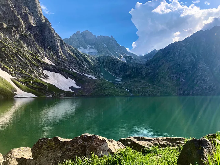
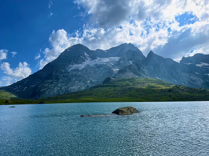
When we saw Vishansar for the first time, we couldn’t believe our eyes. It looked like a precious emerald, with mountains and glaciers all around. We stayed there for about an hour, completely enchanted by its beauty. The good energy in that place was so powerful, I even felt tears welling up in my eyes.
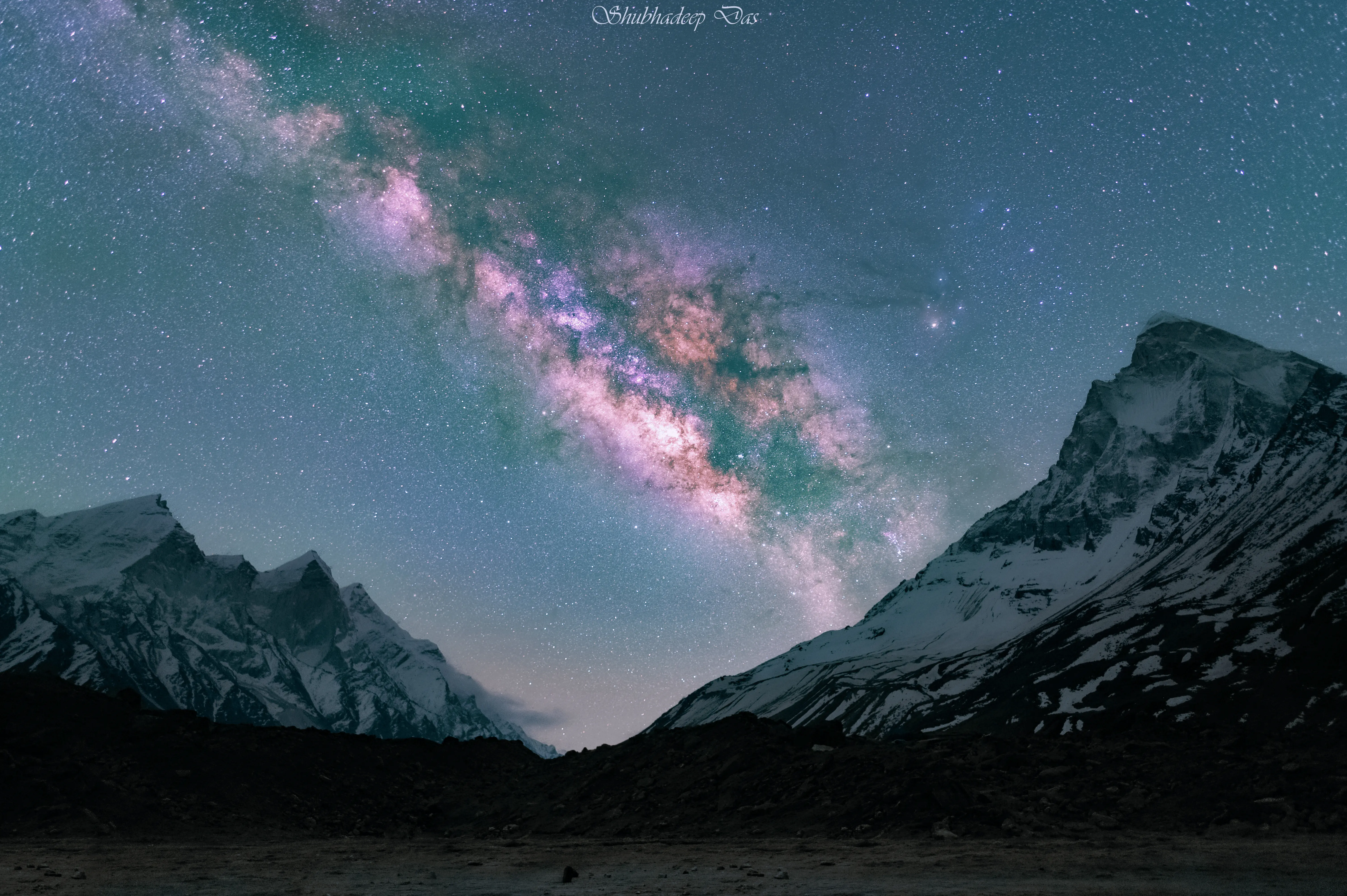
Every morning at camp, we began our day with a nutritious breakfast and brought along packed lunches. For dinner, we enjoyed a hot meal followed by a delicious dessert! Evenings at the campsite were always a blast, filled with good food, games, and stargazing. Our bonds grew stronger as we spent time together. Some of us volunteered to help treat blisters and muscle pains, showing true camaraderie.
DAY 3: Vishansar to Gadsar via Krishansar & Gadsar Pass
Altitude: 12,000 ft to 12,500 ft via 13,800 ft
Distance: 16 km
Krishansar Lake is pretty close to Vishansar, just a kilometer away. But you can’t spot it until the next day after a 45-minute climb because it’s 500 feet higher. It’s a stunning deep-blue lake, nestled under the Krishansar peak. But you can’t see both lakes at the same time from there.
There’s a huge grassy field on the right side. Up ahead, there’s a steep ridge we needed to climb over. The path goes up slowly at first, and you can see a stunning view of Krishansar from the top. We kept stopping every now and then to take in the scenery and snap photos, but it was never quite enough.
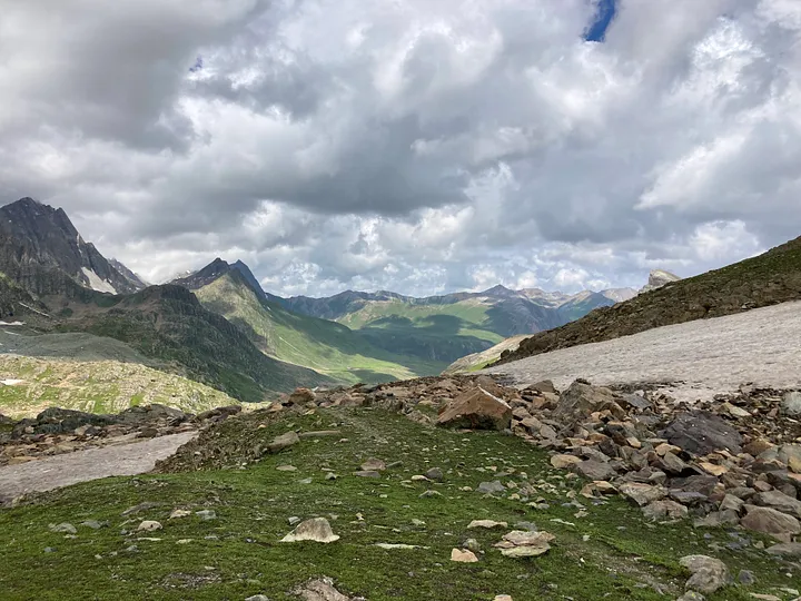
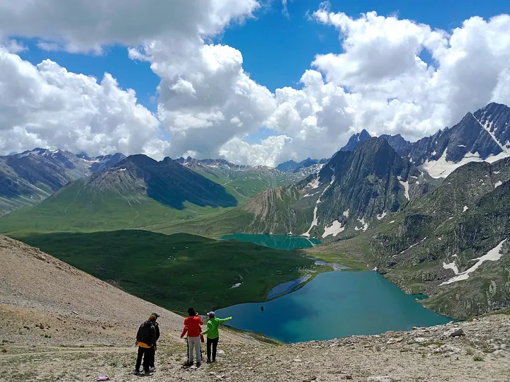
After a while, we spotted the two lakes next to each other. As we reached halfway up, the slope got really steep, making us huff and puff. Climbing higher and higher, we all started to adjust to the altitude, which affected our breathing. The tough journey finally came to an end at the peak of the Gadsar Pass, standing at 13800 ft – the highest point of our trek!
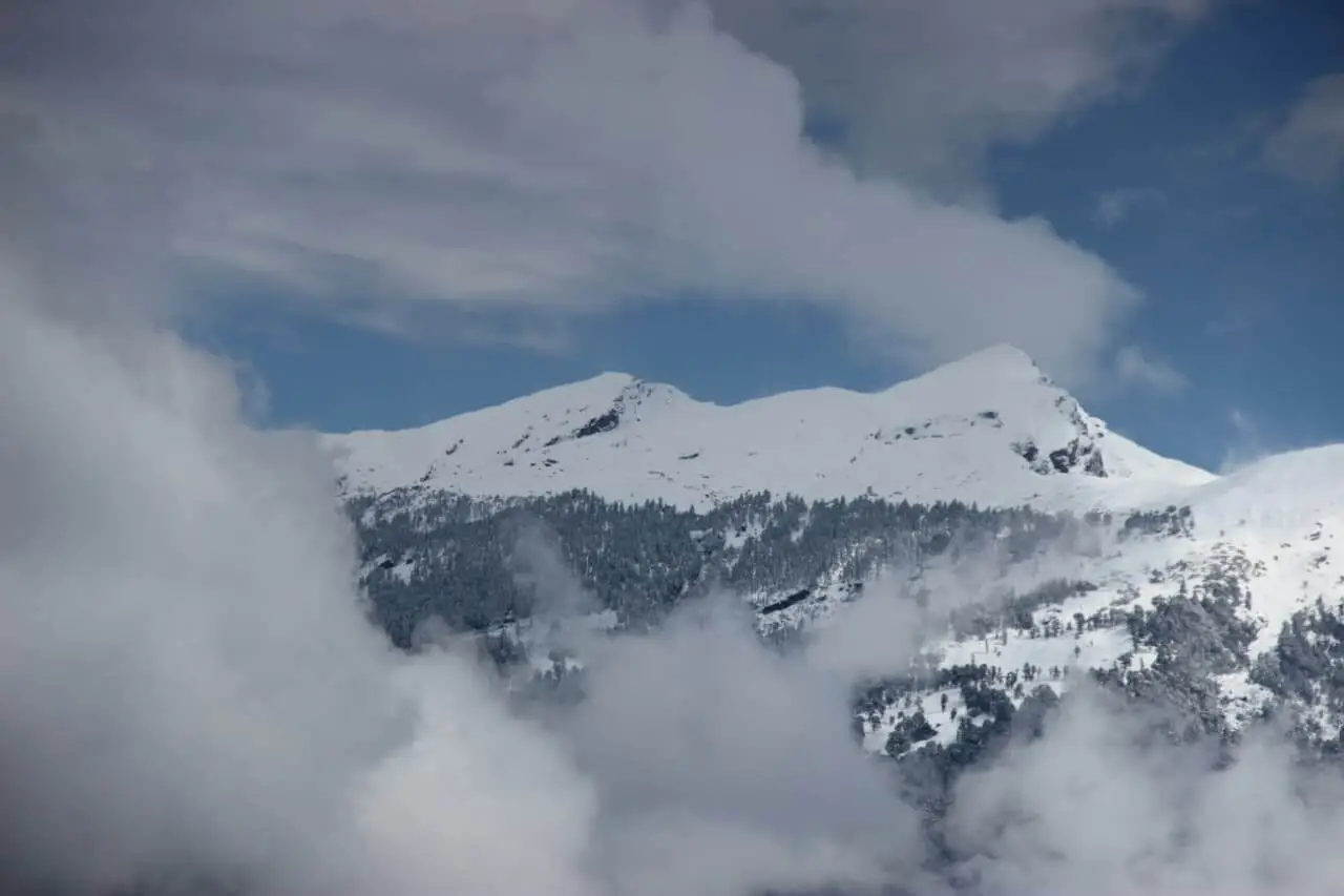
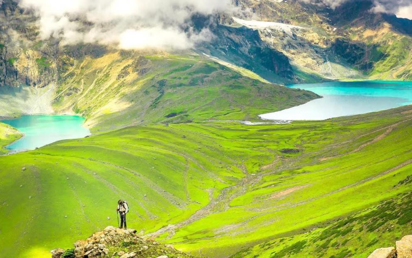
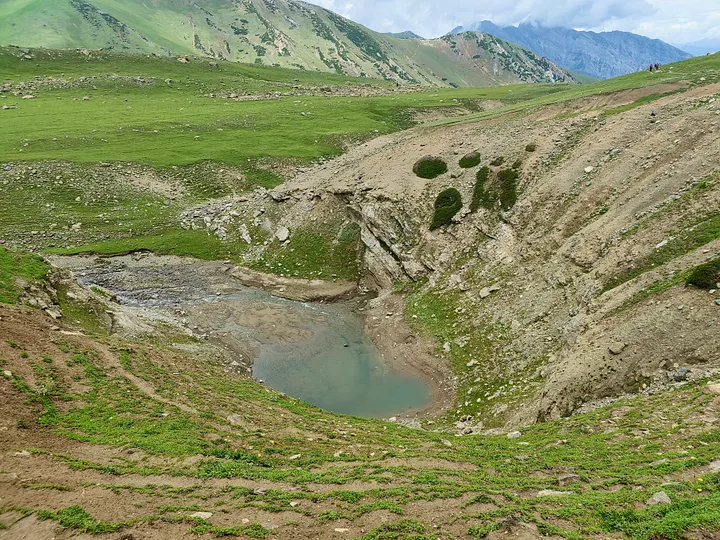
When I reached the top of Gadsar, all my tiredness disappeared. We were all so happy because we had conquered the hardest part! Looking down, we could see the beautiful Vishansar & Krishansar lakes, shining like jewels in the mountains. And when we looked the other way, we saw three more stunning lakes – Yamsar, a nameless lake, and Gadsar. Later that day, we got to see these lakes up close as we walked by them. The locals believe that getting too close to Yamsar or camping there can be dangerous because it’s Lord Yama’s lake! In the distance, we could see a row of snowy peaks. Gadsar pass often gets covered in snow, so we had an extra day just in case, but luckily we didn’t need it.
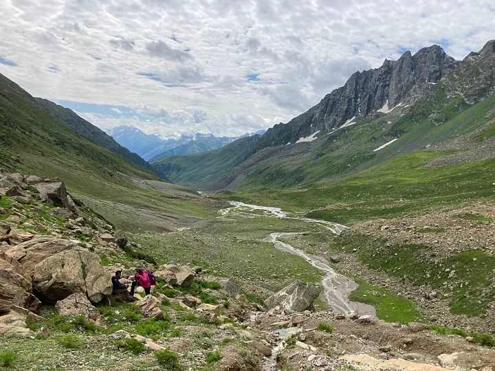
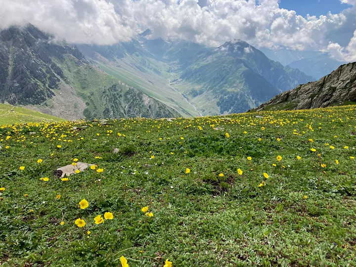
It took us about an hour to go down, and then we were right in the middle of a valley filled with flowers. It was the most beautiful section of our hike. We were strolling through a narrow valley with smooth green fields and two mountain ranges on each side. We passed by three lakes in a row, following a path that seemed like it came straight out of a film.
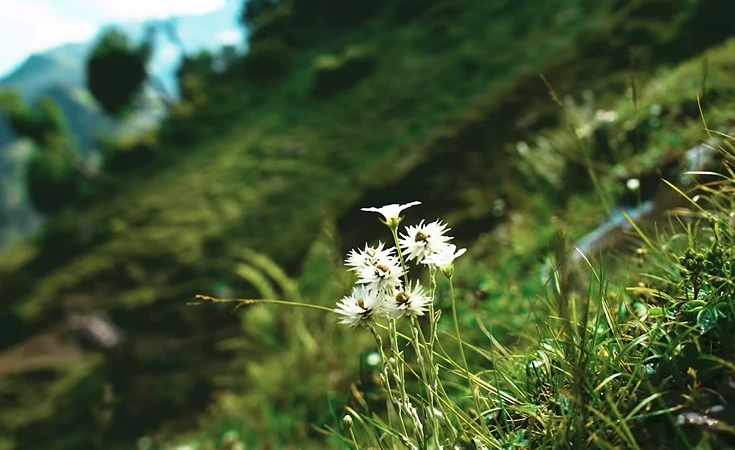
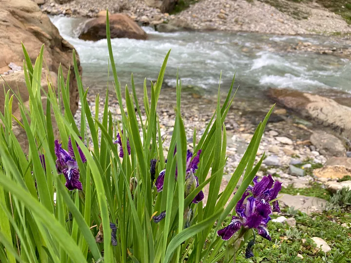
On both sides of the trail, there were so many wild flowers of different colors mixed in with the green grass, making it look really happy and wild. You can walk for miles and see yellow buttercups, purple irises, blue geraniums, and lots of other beautiful flowers! The three lakes are connected by a rushing stream that eventually flows into Gadsar.
You should never underestimate how tough it is to go downhill when you’re trekking. I’ve seen lots of people handle the uphill part easily, but struggle on the way down. Personally, I find going up to be the harder part.
Everyone warned us about how tough it can be to climb the Gadsar Pass. But for me, the real challenge was the Nichnai Pass. Gadsar may seem intimidating, but with a little patience and some breaks, it’s manageable! On the day we tackled the Nichnai Pass, many hikers turned back and some women decided to ride ponies instead.
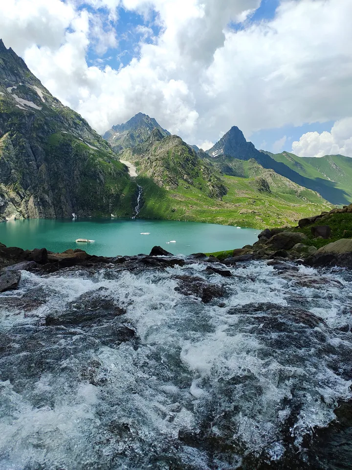
Gadsar Lake is the most beautiful spot on this trek. Tucked away in a valley surrounded by towering mountains, the lake’s turquoise water is speckled with patches of snow. Lush green meadows and vibrant wildflowers complete the picturesque scene. It’s truly a sight to behold. We stopped here for lunch.
DAY 4: Gadsar to Satsar
Altitude: 12,500 ft to 12,000 ft
Distance: 11.5 km
The journey from Gadsar to Satsar wasn’t too long. On this day, we didn’t bring packed lunch because we were going to have a hot meal at the campsite around 2 pm. Normally, we would bring packed lunch every day and eat it by a stream in the meadows or next to a mountain brook! We always did morning and evening stretches as part of our routine.
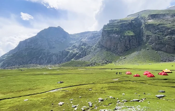
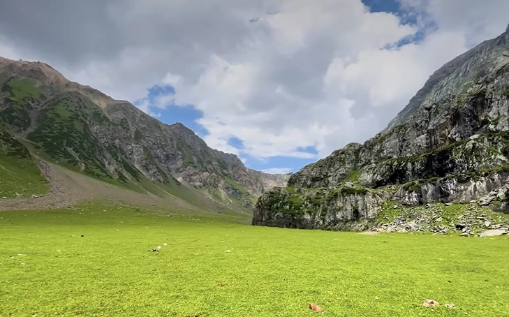
Satsar is a combination of the words Seven and Lakes. Even though these lakes are all close by, it would be hard to visit all of them in just one day.
The fields of Satsar are so well-kept, with a gentle stream flowing through them.
The path from Gadsar started off really narrow. The slope was gentle as we went over the Kasturkoth Pass. There’s no peak for this Pass, but the path goes along the edge of the ridge, eventually leading to a big meadow named Rasbal. Some of us noticed wild strawberries growing on the slope next to the narrow path. They looked safe, so we all tried a few!
There were some craters on both sides of the trail, remnants from the 1965 Indo-Pak war. This area is known as Maengandob. Here, we witnessed something really cool — a stream that was flowing along suddenly disappeared into the earth through a gap in the mountainside. We’re not sure if it comes back up anywhere ahead.
One cool thing is that during our hike, when we reached a certain point on the trail, we could see the faraway Nanga Parbat peak. The weather was great, so we could easily spot the snowy peak.
The day had mostly gentle slopes, but there were a few hours of a really steep climb in the middle.
We mostly walked on a smooth path, but there were some parts with big rocks that we had to carefully walk around. On our hike to the campsite, we passed by three out of the seven lakes. The first lake we saw was so beautiful, with lots of pretty yellow buttercup flowers along the shore.
DAY 5: Satsar to Gangabal & Nundkol
Altitude: 12,000 ft to 11,500 ft
Distance: 9 km
We were almost done with our trek. We spent the day going up and down the trail over and over again. At first, we had to climb over big rocks. We even had to put away our trekking poles for a while. I really enjoyed using my hands and feet to carefully jump from one rock to the next.
You had to be careful of sneaky cracks between the rocks to prevent getting hurt from a fall. Some of us thought this area was really tough to navigate, but others just hopped over the rocks like playing hopscotch!
We were walking through huge rolling fields and then we had to climb for an hour. We had to climb over three ridges in total to get to the top of Zach Pass, which is the last pass we had to cross. It was at 11,500 ft!
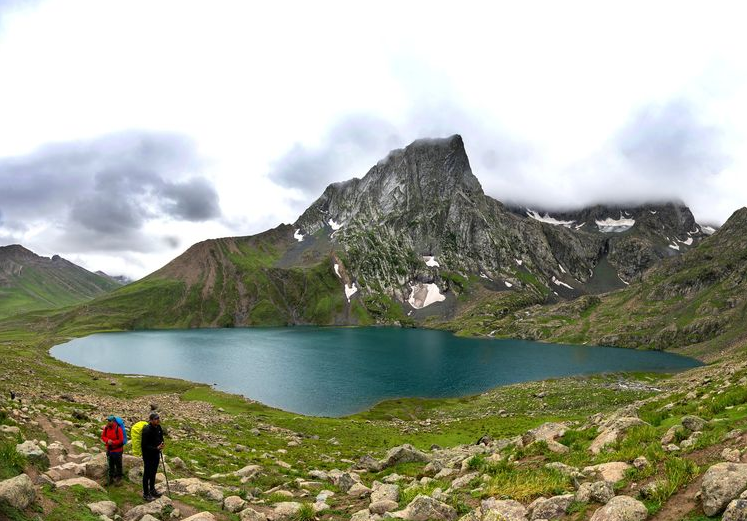
When I reached the top of the pass, I couldn’t believe my eyes. The sight was amazing. There were two beautiful lakes – one was a bright emerald green, and the other was even bigger. The Nundkol lake was on the left, and the Gangabal lake was on the right, right below the Harmukh peak. I even saw another lake without a name on the left, and it was above the other lakes on the mountain.
The group suddenly became quiet as we all gazed at the amazing view in front of us. This was definitely the best part of our whole journey. Despite the sore muscles from the past few days, it was all worth it. The time we spent there was really touching for me. Seeing the lakes and Harmukh mountain together was truly breathtaking.
Not everyone is as fortunate as I am. I am grateful to God for helping me during difficult times and for being lucky enough to witness this beautiful sight. Gangabal and Harmukh are talked about in our old texts and are important places of worship for people from Kashmir. These places connect us to our ancestors who meditated here. Every year, a pilgrimage to Gangabal is made on Ganga Ashtami, which is usually in September.
Going down to Gangabal took a while. We had a really nice time there for a little bit. Gangabal is definitely the coolest and most amazing lake on this trip. Sitting there, watching the peaceful water of this special lake with Harmukh above you, is a really spiritual thing. We listened to Shiva songs while the cold water splashed on our feet and the sun went down behind the mountains.
It was getting dark. We walked for around 20 minutes to get to Nundkol. Krenknadi stream links Gangabal to Nundkol, then flows out from Nundkol to meet Wangath nallah, which eventually joins river Sind at Naran Nag. To reach our campsite at Nundkol, we had to cross a narrow log bridge.
DAY 6: Gangabal to Naranag
Altitude: 11,500 ft to 7,450 ft
Distance: 13 km
The final day – and I felt satisfied.
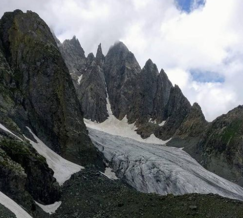
We were informed that it would be a lengthy day and to arrive at Naranag by 2 pm, we had to begin early. Our camp was set up at Nundkol right below Mount Harmukh and we could spot the massive Harmukh glacier from there. We took down our tents for the final time, did our stretches, expressed gratitude to all the supporting staff, and embarked on our journey for one last time.
The first part of our journey down was through a big, rolling field with lots of tall pine trees lining the path. It felt nice to see the trees again after not seeing many at the higher elevations. We took one final glance back at Harmukh from this new perspective before it disappeared from view. It was a stunning sight against the clear blue sky.
As we continued our journey, we reached an army check-post where they inspected our documents. After a friendly chat, we bid them farewell. It felt like we were finally meeting other people after a long time! We then had to descend the mountain Butsher. The first part of the trek involved both uphill and downhill sections, but the second half was a real challenge for our knees and toes. The descent was steep and never-ending, with loose stones and gravel making it even more difficult. We had to be careful with every step we took. We were warned to stick together as we descended through thick pine forests, which were home to bears. This part of the trek was the first time I felt frustrated. The trail seemed to wind endlessly down the mountain, causing intense pain in my feet and lasting numbness in my toes for a month after the trek!
When we saw Naranag town and the Wangath nallah winding through it, we were only halfway there, but it didn’t make things easier. We were still really high up. Actually, in the final 4 km, we descended over 3,000 ft, showing just how steep it was.
In short, the final part of the day was super tough and we didn’t see it coming. When I saw the Naranag temple ruins peeking through the pine trees, I realized I was so close. The bumpy path eventually brought me to the stone-covered village road that connected to the main road in Naranag.
We all stuffed ourselves with the delicious food at a restaurant that served real Kashmiri dishes. Then we grabbed our bags, took the final group photos, and said our goodbyes, promising to meet again on another Himalayan hike someday. After that, we left for Srinagar.
Also Visit:
Share Article:
admin_mountain